
The model allows users to customize a set of variables, making it useful for other crops in different agricultural contexts. Thus, it has the potential to provide more accurate estimates during harvests and contribute to the development of public policies that support production chains and insurance systems.
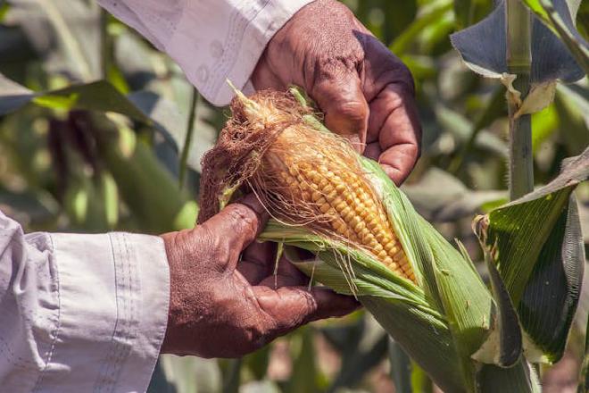
In the study, the scientists mapped over 700,000 hectares of corn planted for the second harvest in the western mesoregion of Paraná state (in the areas around Toledo and Cascavel) to identify damage caused by severe frosts recorded between May and June of 2021.
The scientists integrated optical remote sensing data (MultiSpectral Instrument sensor with medium spatial resolution aboard the Sentinel-2 mission satellites) with machine learning techniques (Random Forest algorithm). They achieved 96% accuracy in mapping corn crops and revealed that 70% were damaged by frost during that time. They were able to map the affected areas using the method they called GEEadas.
The results were published in the December issue of the journal Remote Sensing Applications: Society and Environment.
Adami has been working with Professor Michel Eustáquio Dantas Chaves, from the Faculty of Sciences and Engineering at São Paulo State University (UNESP) in Tupã, for several years on remote sensing research focused on practical applications in agriculture.
“Producers still face a number of climatic uncertainties during the harvest, especially when there are extreme events, such as frost, which have social, economic, and environmental impacts. In such cases, it’s necessary to identify how much of the crop has been affected in order to inform the farmer, the banks that grant credit, or institutional bodies. This method provides accuracy, indicating the affected area and reducing uncertainties,” said Chaves, first author of the article, which received support from FAPESP.
Importance of the sector #
In its October 2025 estimate, the Brazilian Institute of Geography and Statistics (IBGE) reported that the national harvest of cereals, legumes, and oilseeds reached 345.6 million tons, which is 18% higher than in 2024 and a record high in the historical series. The three main products are rice, corn, and soybeans, which together account for 93% of the estimated production and 88% of the harvested area.
Paraná is the second-largest grain producer in Brazil, behind only Mato Grosso. The production estimate for corn in 2025 was 141.6 million tons, which is also a record.
Generally, the second corn crop is riskier than the first due to lower water availability and exposure to climatic events, including frost. Despite having frost risk warning systems, Brazil lacks accurate methodologies to assess damage.
To validate the method, the researchers compared corn mapping areas and frost damage estimates with official data provided by the State Department of Agriculture and Supply. They also used information from insurance companies. Farmers typically file insurance claims to recover losses caused by adverse events. For each claim, an agricultural specialist visits the farm and analyzes the damage.
“In the field, agricultural technicians have spatial limitations, which are natural to the activity. Seeing from above with remote sensing images allows us to complement the technicians’ work,” Chaves explained to Agência FAPESP.
Citation #
- The study GEEadas: GEE-based automatic detection of adverse-frost stress was published on Remote Sensing of Environment. Authors: Michel E.D. Chaves, Marcos Adami, Lucas Volochen Oldoni, Grazieli Rodigheri, Victor Hugo R Prudente, Cleverton Tiago Carneiro de Santana, André Garcia, Renan Moreira Covre & Ieda Del’Arco Sanches.
Contact [Notaspampeanas](mailto: notaspampeanas@gmail.com)